


Jane Jacobs, patron saint of human-oriented planning, always talked about the city having its own DNA. She’d tell you that planning in the classical sense is swimming against the natural order of human lives in close quarters. That’s why the best neighborhoods in the best cities -- the West Village in New York, Bairro Alto in Lisbon, Shibuya in Tokyo -- are more scattered and organic. It’s the way we’ve adjusted to living on top of each other. Trying to counteract that only yields stilted, synthetic urban messes. Most of the very walkable American cities grew up before cars made “planned communities” a thing. That’s no coincidence.
These cities here, though, are the least-walkable in
America, and offer a grab-bag of urban tragedy. They’re all painfully
horizontal cities, built to satisfy cars more than pedestrians, and are
only lately discovering the benefits of dedicated public transportation
infrastructure. But they also have one thing in common: They’re all
trying to change for the better. (Just like last time, we’re using two
different exhaustive studies on walkability: Smart Growth America’s “Foot Traffic Ahead” and Redfin’s annual Walk Score
rankings.) These might be the least-walkable cities in the country
right now, but check in a few years from now. They’re working on it.
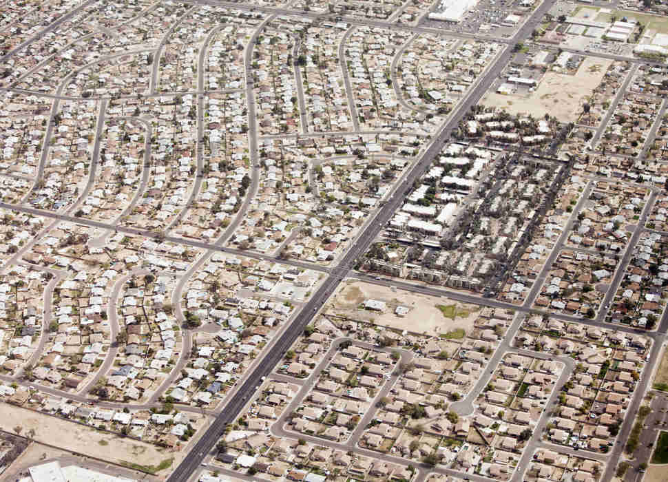
Phoenix
Walking across Phoenix is like a slog through a desert, plus the
occasional McDonalds. That people thought it was a good idea to
move/retire to the Sonoran desert might have something to do with the
city’s reputation as a transit and pedestrian wasteland: Half the time,
it’s just too damn hot to be outside. Combine that with the blob-like
sprawl the city has embraced over the past few decades -- recall the Onion headline “New Study Finds Most of Earth’s Landmass will be Phoenix Suburb by 2050” -- and you have an urban area that almost requires you to have a car in order to live.
Phoenix hasn’t shied away from spending on
transportation projects in the past. It's one of the only cities on this
list with a halfway decent light rail system, and it looks like the
city is planning on investing heavily in public infrastructure thanks to
the ambitious T2050 plan.
Phoenix voters approved the the 35-year transportation development plan
back in August of 2015; it promises several new rail lines, street
improvements, and an overhauled bus program. That sort of public support
is a huge signal that even cities dominated by suburban sprawl are
moving toward a smarter, more accessible future.
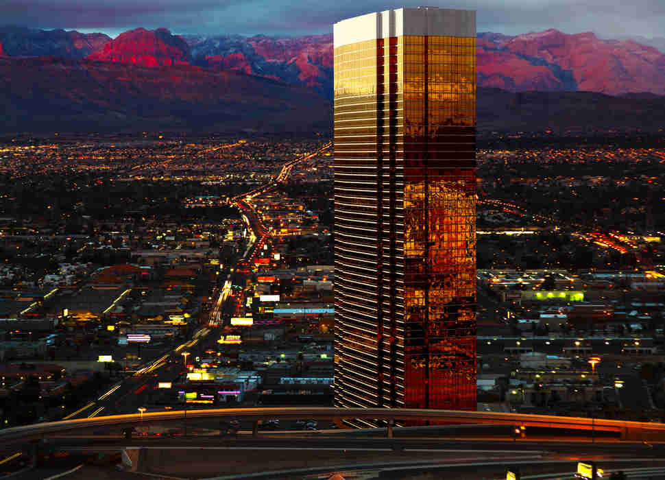
Las Vegas
Las Vegas is really two cities. There’s the one most of us know:
the glitz and gambling dominated by the Strip, Vegas’ neon spine. That
city is easily accessible and connected by air-conditioned walkways and
that Lyle Lanley-approved monorail that shuttles gamblers and bachelor
parties from casino floor to casino floor. (It’s said that the monorail
is powered entirely by human dignity.) The other Vegas is the one that
only your blackjack dealer or concierge knows about, the one that
demands a car to get around. That Vegas is home to a paltry transit
network that places bus stops on unshaded 120-degree sidewalks. It’s
dominated by snarling traffic thanks to roads that haven’t been
overhauled since Sinatra and Dino were on the marquee at the Sands. That
Vegas decided the crappiness of its bus system wasn’t going to prevent
it from shoveling $750 million at the Raiders.
The most high-profile of Las Vegas’ actual attempts
to reimagine its urban network is Tony Hsieh’s “Downtown Project,” an
initiative that sought to build a “City as a Startup” within Las Vegas’
city limits. Hsieh’s vision was more Moses than Jacobs, leading Columbia professor Leah Meisterlin to offer a withering critique of the project for The Avery Review.
“Walking along Fremont, I felt no active excitement, spontaneity, or
curiosity,” she wrote, “but rather the growth of a scripted narrative
and a correspondingly enforced restraint.” Yikes.
Luckily, Las Vegas is looking at more practical
solutions to its development woes that will appeal to pedestrians. The
Regional Transportation Commission of Southern Nevada recently unveiled a
30-year plan
to completely reshape the city’s downtown. Look for Vegas to expand
residential and commercial space in Vegas’ core and to build a transit
system that connects McCarran International Airport to downtown and the
Strip, potentially alleviating the most congested stretch of road in the
state.
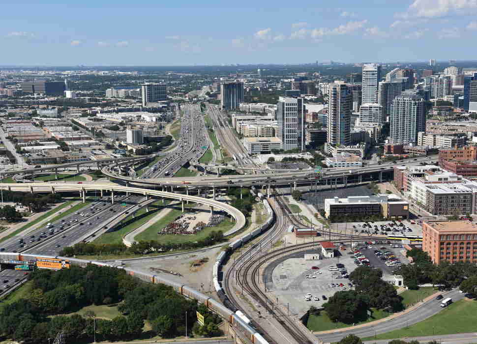
Dallas
I’m just going to get this out of the way: Everything actually is bigger
in Texas. Even the city blocks, which, in the words of my friend and
Dallas-native Dave feel “like the length of entire neighborhoods in New
York.” Those gargantuan block lengths are actually a terrible move for
walkability, since they discourage people from doing anything but
hopping in a car the minute they get outside. Dallas, like a lot of
Sunbelt cities, sprawls mightily, built on the back of a housing boom
that prioritized horizontal space to vertical density. Even the suburbs
here are Texas-sized.
Even Dallas is improving, though. The city has invested $5 billion
to build the longest light rail system in America, with 90 miles of
track. The hub-and-spoke network has ushered in a transit-oriented
development boom circling downtown with neighborhoods
like Deep Ellum, Uptown, and the Bishops Arts District all seeing a
pedestrian-friendly renaissance over the last decade.
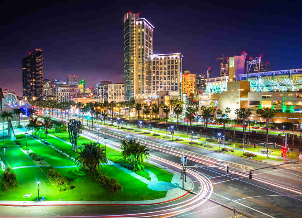
San Diego
Wasn’t the California city you were expecting, huh? Well, contrary to
popular belief, Los Angeles is actually smack dab in the middle of Smart
Growth America’s walkability rankings. San Diego sits near the bottom.
The beachside city of more than a million isn’t terrible at any one
thing when it comes to walkability, but it also doesn't excel in any of
the metrics.
That said, San Diego is trying to change that image.
Its planning department is leading the charge as one the most
innovative and progressive in the country. Case in point is San Diego’s
attempt to become one of the greenest cities in America by reducing traffic in its congested downtown and expanding its bike lane network. San Diego also just committed $2.1 billion for a new light rail extension
that will connect downtown to University City, potentially creating an
11-mile corridor of transit-oriented development that shrink the already
slim list of reasons why we don’t all live in San Diego already.
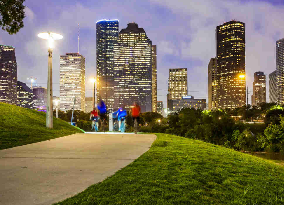
Houston
Texas and bigness again. Houston takes up 627 square miles, making it
more than twice as large as Singapore with about 40% as many residents.
Houston is sprawl defined, and that lack of density is the reason it
makes our list. Dubbed “The Blob That Ate East Texas,” Houston is one of
those quintessentially American cities not limited by any natural
geographic barriers like mountains or bodies of water. Sprawl was a
business decision for developers, as there’s a lot less risk building
horizontally than vertically.
But Houston is discovering that sprawl isn’t a
permanent blight, and the city has seen significant private and public
investment in its urban core. Over the past eight years, Houston has
completely reimagined its transit network by opening two new light rail
lines and expanding another. Two additional lines are in the works with
one slated to be completed by 2019. Houston also grew its bike sharing
network from just 18 bikes in 2012 to more than 300 now. (Administrators
are aiming for 1,000 by the end of 2017.)
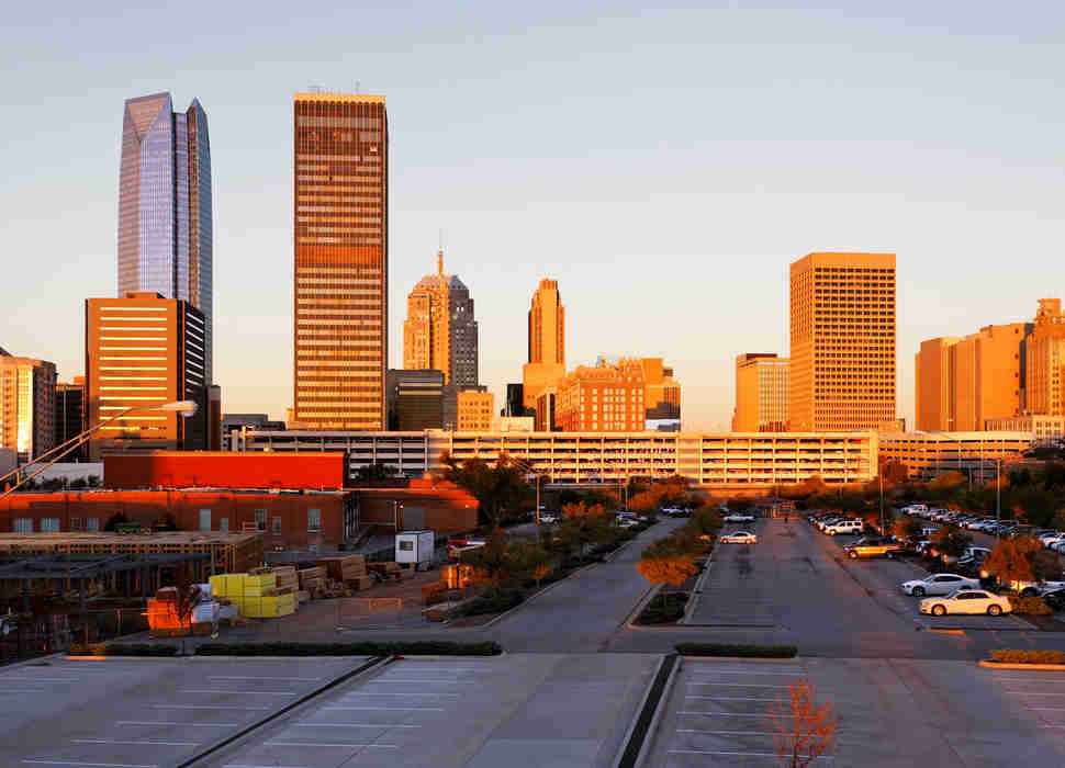
Oklahoma City
I have never been to Oklahoma, as I am not down with tornadoes. But I
did talk to my good friend Pat, who was born and raised in OKC, about
his hometown. “The problem is that once you get away from Bricktown and
[home of the Thunder] Chesapeake Energy Arena, it’s incredibly
unwalkable,” he told me. “OKC is almost the same size as Los Angeles but
our public transit system is even worse if you can believe
it.” That’s damning criticism and the data backs it up: OKC scored a
dismal 32.1 on Redfin’s Walk Score, the worst of any city on this list
by a wide margin.
Back in 2015, Oklahoma City mayor Mick Cornett issued a blunt public health challenge to his constituents: Lose some weight.
(OKC has a high rate of obesity for a lot of reasons, the city’s
dependence on cars and its lack infrastructure for pedestrians or
cyclists among them.) It was a refreshingly frank policy initiative and
Oklahomans took it seriously, losing more than a million collective
pounds in the process. Mayor Cornett also backed several wide-ranging
programs to help design a more active city, including spending more than
$3 billion on reimagining the city’s car-oriented downtown. As Jeff Speck, author of Walkable City told Mosaic magazine back in 2015, “The American healthcare crisis is an urban design problem.”
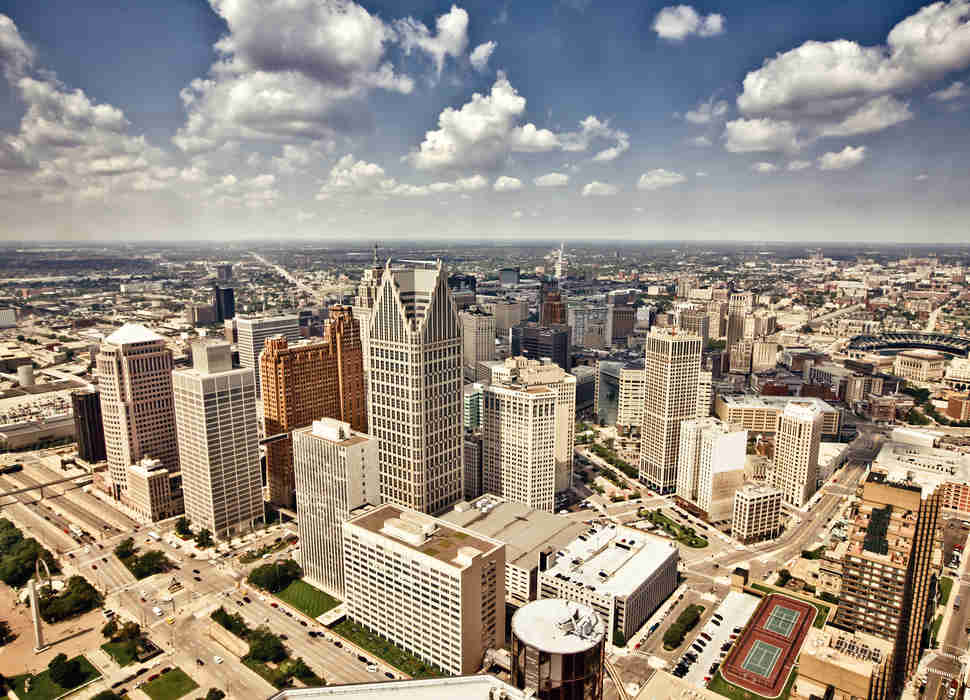
Detroit
Of course the former cradle of automobile production made this list.
Detroit was around long before Henry Ford started rolling out Model Ts
in the 1920s, but development throughout the 20th century orbited around
the city’s most famous product. Detroit has also seen hundreds of
thousands of urban residents abscond for the suburbs which has emptied
out city coffers and fed a belt of sprawling suburbs. The Motor City is
finding its feet again after a devastating recession; for now the best
way to see the city is behind the wheel of a couple thousand pounds of
American muscle.
Detroit still ranks near the bottom of Smart Growth
America’s rankings but there is a silver lining: For increasing
walkability, the city came in third overall. That’s thanks to several
major developers investing hundreds of millions of dollars in the city’s
revitalization, culminating in Dan Gilbert’s decision to move Quicken
Loans headquarters -- and 11,000 jobs -- downtown. Corktown, Detroit’s
oldest neighborhood, and Midtown are two neighborhoods to check out on
foot and, with the recent opening of the city’s long-awaited light rail
system, by streetcar as well.


No comments:
Post a Comment